
by Patti Dahlberg
 According to the Colorado Department of Transportation (CDOT) Historic Timeline featured on its website, CDOT has been around in some form or another since 1910 – amazingly, only about six years after the first automobile reportedly showed up in Colorado and about 15 years after the first sale of an American-made gasoline car. The introduction of the automobile in Colorado and the commitment to improving the roads “paved the way” for easier travel throughout the state. In many ways, the story of CDOT is the story of the state of Colorado opening its doors for all to explore and enjoy. With the founding of the department, Colorado soon became a tourist destination.
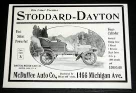 Purportedly, the first automobile in Colorado appeared in 1904 in Louisville. The first reported trip up a mountain road made by an automobile seems to have taken place in June of 1910, when Francis Percy “Frank” Loveland, the grandson of Colorado pioneer businessman W.A.H. Loveland, of Loveland Pass and the city of Loveland fame, drove up an old carriage road (with a 2,000 foot elevation change) from the Denver-metro area to the top of Mount Falcon (near Red Rocks). The 24-year-old drove his Stoddard-Dayton touring car from Morrison to the Mount Falcon summit (elevation 7,851 feet) in about 20 minutes. An hour earlier, he had set another record by driving from the Capitol building to Morrison in only 29 minutes.
So how did we get all these roads that take us just about anywhere we want to go to? It started in the late 1870s with the “Good Roads Movement.” Through this movement, which lasted into the 1920s, farmers’ and bicyclists’ organizations advocated for the investment of state and federal money in improving roads outside of the cities. At the time, the rural roads were dirt or gravel, which meant mud in winter, dust in summer, and slow travel year round. Obviously, these roads were generally bad for bringing goods to market and, of course, for bicycling. And in the mountains, wagon roads could be difficult to navigate and unusable for large portions of the year. When automobiles appeared on the scene, the automobile lobbies wholeheartedly joined in the movement.
Colorado’s Legislature created its first State Highway Commission in 1909, charging it with the responsibility of establishing a network of state primary roads. In 1913, the Legislature created a series of registration and licensing fees as a funding source for the improvement of the Commission’s proposed 4,380-mile primary road system. The fees varied from $2.50 to $10 (from around $40 to $160 in today’s dollars) depending on the vehicle’s horsepower. By 1915, Colorado’s proposed highway system grew to 5,844 miles, but only about 2,600 miles of those roads were constructed and only 196 miles of them were actually surfaced.
 By the time Congress passed the Federal Aid Road Act of 1916, which provided federal matching funds for state highway projects, Colorado had already been busy constructing roads and mountain passes. In fact, a new automobile road over Wolf Creek Pass was opened to traffic that same year. In 1917, the Legislature reorganized its State Highway Commission into the State Highway Department and passed legislation to create a state highway fund to distribute state and federal funds to develop and maintain Colorado’s highway system. By 1918, the Highway Department laid the first concrete road in the state, which ran from Littleton to Denver along Santa Fe Drive. A year later, Colorado was one of the first four states to pass a gasoline tax, one-cent per gallon (the average price at the time was 25 cents/gallon, $3.22 per gallon in today’s dollars), to raise revenue for a special road fund.
In 1921, the Legislature, largely in response to the U.S. Bureau of Public Roads’ (BPR) willingness to provide federal aid to states, reshaped and expanded the bureaucracy of the State Highway Department. In 1922, Colorado voters deemed transportation important enough to approve $6 million in bonds for highway construction, which would be over $1 billion today. The BPR approved Colorado’s first federally aided road system, covering 3,332 miles. By 1929 the Colorado State Highway system had grown to 9,203 miles, and by 1938 it was almost 12,000 miles.
Mountain Roads, Scenic and Historic Byways
 Colorado is home to 26 Scenic and Historic Byways, around half of which are also designated as National Scenic Byways and recognized for their outstanding scenic and historic attributes. Colorado has more national designations than any other state. In 1924, the State Highway Department completed the “Million Dollar Highway,” the Scenic Byway through the San Juan Mountains in Southwestern Colorado on U.S. 550. In 1927, the Mount Evans Highway was completed and opened for travel to an elevation of 14,130 feet, just below the 14,264-foot summit of the mountain. It remains the highest elevation for a paved highway in North America.
The first automobile crossed Loveland Pass on September 29, 1929, and in that same month work on Trail Ridge Road – the highest continuous paved road in the United States, had begun. The Great Depression brought in federal work projects to help Colorado continue to construct and maintain its mountain highways, as anyone who has driven over Trail Ridge Road and read any of the signs knows. Between 1938 and 1940, Colorado completed the roads over Berthoud Pass (U.S. Hwy 40), Monarch Pass, and the original highway (U.S. Hwy 6) over Vail Pass. Gold prospectors may have brought skiing to the Colorado Rockies in the 1860s, but it was passable mountain roads that enabled it to become the popular winter sport that it is today.
 The boring of the westbound Straight Creek Tunnel (later to be named the Eisenhower Memorial Tunnel) through the Continental Divide to align I-70 near Vail with the existing U.S. Hwy 6 started in 1963 and finished in 1973. The eastbound bore of the Continental Divide tunnel opened in 1979 and was named in honor of former U.S. Senator and Colorado Governor Edwin C. Johnson. The combined tunnels are now officially known as the Eisenhower-Johnson Memorial Tunnel complex.
 And then there’s the crown jewel of Colorado mountain highways – I-70 through Glenwood Canyon. Construction began on “the final link” of west-bound I-70 through the canyon in 1980. Less than 15 miles long, the segment was completed in October of 1992 for around half-a-billion dollars. One of the biggest challenges CDOT faced was how to squeeze a four-lane freeway into a gorge barely wide enough to accommodate the existing two-lane highway and how to do so with minimal impact to the environment. CDOT’s solution was clever: construct two roadways, one nearly on top of the other. The final design features an elevated roadway with 40 bridges and viaducts spanning more than six miles between sections. Construction materials included 15 miles of retaining walls, two 4,000 foot tunnels, 150,000 newly planted trees and shrubs, 30,000 tons of steel, and 810,000 tons of concrete. Soon to be 30 years old, the Glenwood Canyon portion of I-70 is not only a beautiful stretch of road, but considered by many to be a modern marvel. The two-tiered elegantly sculpted highway through the Colorado River gorge remains a vital transportation corridor and a popular tourist attraction. The 12.5-mile engineering feat has received a presidential commendation and numerous design awards. It has been featured in books and in a museum exhibit on 20th century engineering achievements.
Sources:
- https://www.codot.gov/about/CDOTHistory/centennial/timeline
- https://www.history.com/topics/inventions/automobiles
- https://www.historycolorado.org/story/collections-library/2017/05/30/auto-record-setter-and-murderers-friend-frank-p-loveland
- https://www.valleyreporter.com/index.php/news/local-news/8950-who-bought-the-first-car-sold-in-america
- https://highways.dot.gov/public-roads/summer-1996/federal-aid-road-act-1916-building-foundation
- https://en.wikipedia.org/wiki/Good_Roads_Movement
- https://www.colorado.com/articles/quick-guide-colorados-scenic-historic-byways
- https://www.scenic.org/visual-pollution-issues/scenic-byways/scenic-byway-maps-by-state/
- https://coloradoencyclopedia.org/article/trail-ridge-road
- https://www.codot.gov/news/2012-news-releases/10-2012/colorados-i-70-through-glenwood-canyon-remains-an-engineering-marvel
- https://highways.dot.gov/public-roads/marchapril-2004/glenwood-canyon-12-years-later
- https://www.tampabay.com/archive/2001/10/14/true-west-a-canyon-and-its-highway/
- https://www.youtube.com/watch?app=desktop&v=etf0DzR8T00